Siberian High pressure system to hit Greece from Thursday

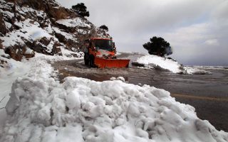
Meteorologists on Wednesday warned that a high-pressure system from Siberia is expected to sweep into Greece on Thursday, bringing freezing temperatures and snow to many parts of the country, including the capital.
According to forecasts so far, temperatures in Athens will drop below the 0-Celsius mark for about three days from Friday, with the wind-chill factor making it feel like -10 Celsius in the capital’s northern suburbs and mountains. In other parts of the country that are accustomed to wintry conditions, the wind-chill factor is expected to be as low as -25 Celsius.
Speaking to the newspaper Ethnos, the deputy director of the Hellenic National Meteorological Service (HNMS), Thodoris Kolydas, said that the new cold snap is expected to be significantly more severe than the one that ushered in the new year.
“This is from the Siberian High being activated and bringing waves of cold weather to Greece. It is northeasterly system that carries cold masses from Ukraine and the Black Sea. It is the same anticyclone that was responsible for the snowfall of 2002, 2004 and 2008,” he said.
“On Thursday it will snow in Thessaloniki, while Athens will see its first snowfall on Friday afternoon, continuing through Saturday and starting to abate on Sunday and Monday,” Kolydas added.
The weather system is also expected to bring showers and storms to some parts of the country, mainly in the west.