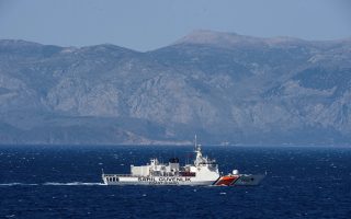
Developments over Greece’s territorial waters
The announcement last month by former foreign minister Nikos Kotzias about plans concerning Greece’s territorial waters in the Ionian Sea came after two years of preparation of the presidential decree to extend them from 6 to 12 nautical miles.
But the decree itself foresees that the extension in the Ionian represents a first stage, which will be followed by others, until the territorial waters of the entire Greek mainland along with the islands of Evia and Crete reach 12 nautical miles.
The extension of territorial waters in the Ionian Sea is the result of an option granted to coastal states by the 1982 United Nations Convention on the Law of the Sea, which allows states to extend their sovereign territorial waters to a maximum of 12 nautical miles – a rule that, due to its extensive ratification by many states, has become a customary law, which also binds non-signatories to the convention.
The extension is one of the very few unilateral actions allowed by the Law of the Sea, which means every coastal state can take it without requiring the express consent of neighboring countries or the international community. It became imperative to extend Greece’s territorial waters in the Ionian Sea due to the renegotiation of agreements delimiting the country’s exclusive economic zone (EEZ) with Albania and Italy.
In talks between Greece and Albania, the two states agreed to close off bays and adopt straight baseline delimitations to replace the natural shoreline, which was depriving Greece of small sections of territorial sovereignty and complicated the outer boundaries of its territorial waters due to the morphology of its coasts.
The delimitation agreement with Albania was never ratified because the country’s Constitutional Court found it unconstitutional and therefore the process came to a halt. Today, with the improvement of Greek-Albanian relations, Greece is proceeding with comprehensive adjustments on the outstanding issues with Albania, including the delimitation agreement.
As a result, the extension of Greece’s territorial waters will first of all modify the country’s baseline in its favor, by switching from the natural coastline to straight lines, which will slightly increase the country’s sea territory. More importantly, territory which in the past was designated as open sea, subject to the continental shelf / EEZ regime, will automatically become part of Greece.
Concerning Italy, efforts are aimed at revising the 1977 agreement Greece signed with its western neighbor on the delimitation of the respective continental shelf areas to include an agreement on the EEZ. The agreement has been delayed because of objections raised by Italian fishermen who fish freely outside the Greek territorial waters and fear that turning the agreement on the continental shelf into a deal on the EEZ will deprive them of resources, since the exclusive right to fishing inside that zone will be handed over to Greece.
By extending the territorial waters to 12 nautical miles, the problem is automatically solved, because Italian fishermen who fish inside the 12-mile radius will from then on have to obtain the permission of Greek authorities.
As regards the question of whether the partial extension excludes further demarcation of territorial waters in the Aegean Sea, it is important to mention the following: The extension in the Ionian Sea is only part of a complete process that will eventually cover all the seas surrounding Greece. The Ionian will be followed by the delineation of the territorial waters on the mainland’s Aegean side, as well as the islands of Evia and Crete, as mentioned above.
As for the islands of the Aegean, a different approach has been proposed to avoid turning the sea into a “Greek lake,” which would be the case if each island applied the 12-mile rule.
This is because the legal aspect of the territorial waters would hamper free navigation by enforcing strict controls on shipping routes and surveillance by local authorities to make sure vessels comply with rules on innocent passage. If this is not ensured, the coastal state can interrupt a ship’s route and force it to either comply with the rules or leave its territorial sea.
Taking into account that, apart from Greece and Turkey, Russia uses the Aegean Sea as its only route to and from the Black Sea and considers it the only passageway to the Mediterranean and the rest of the world, and that the United States has strategic interests in the Black Sea, one understands the importance of an open sea passage.
This means a different delimitation of the Greek territorial sea is required so as to preserve some open passageways in Aegean Sea. Furthermore, Greece’s partial extension of its territorial waters to 12 nautical miles in the Ionian has brought to the fore the issue of the non-use of the right to extend territorial waters.
Apart from the fact that the existence of the non-use clause in international law is very problematic, Greece has repeatedly stressed that the 12-mile extension in the Aegean will take place when the country considers that conditions are in place for this move.
Under a law that is based on consensus and the will of a state, which must be expressed, it would be strange if the non-use would be reason to freeze the right.
Concluding, we believe the plan to extend territorial waters in the Ionian Sea is an attempt to modernize the institution which, despite the way it was announced, is a major success of our foreign policy.
Christos Rozakis is Professor Emeritus of International Institutions at the University of Athens.