Fire in Athens seaside suburbs burnt 430 hectares, satellite images show
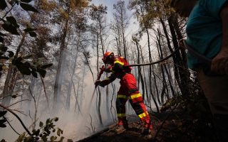
The fire that broke out in the Athens seaside suburbs of Glyfada, Voula and Vari at the weekend has burnt 432.2 hectares of land, according to a report by the EU’s Copernicus Emergency Management Service – Mapping on Tuesday, using data collected by its satellite.
The service was activated by Greece’s General Secretariat for Civil Protection planning and emergency response directorate, as soon as the fire was contained, to get a precise estimate of the damage.
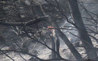
Of the areas burnt, some 300 hectares were reforested land that had been replanted with trees in the 1970s, following a great fire in 1974 that had burnt the entire southern flank of Mount Hymettus. The rest had also been reforested in the past but had been burnt again multiple times, so that the vegetation was mostly low.
Estimates of the damage, especially to buildings and infrastructure, are also being carried out by the fire brigade and local authority services door-to-door.
So far, it appears that 11 buildings have sustained damage, mostly to their exterior, while in one the fire entered the house on both floors and in another it burnt the roof. One car and one motorbike were completely destroyed and two more cars suffered fire damage.
[AMNA]