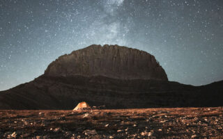
Greece’s complete geological makeup in 330 pages
After 60 years of research, the first comprehensive survey has been completed, unveiling secrets dating back as far as 20 million years
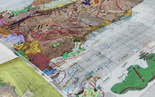
It took six decades, countless field surveys in the Greek countryside and thousands of man-hours in microbiological laboratories and on drawing boards to complete the first geological map of Greece. The Hellenic Survey of Geology and Mineral Exploration (EAGME) is responsible for this important work, which shows with absolute accuracy the country’s geological profile.
Geological maps show the distribution of rocks and the geological characteristics of an area over millions of years. Their importance is immense, since deciphering the geological DNA is the compass for effective land management and for dealing with geomorphological-geological hazards (such as landslides, floods, terrestrial and coastal erosion etc).
The information obtained is valuable to regions and municipalities for decision-making in activities such as road construction. It is also an essential tool for the development of a new sector of thematic tourism, geotourism, and helps to identify underground aquifers and mineral resources and explain the Earth’s terrain.
“Geology students, seismologists, technical experts at local authorities, infrastructure workers and engineers at construction companies will have a precision tool in their hands,” Dr Adonis Photiades, a field geologist-mapper with 35 years of experience, tells Kathimerini.
The new map depicts the impressive geology of Greece at a scale of 1:50,000, meaning that 1 centimeter on the map corresponds to 500 meters on the ground.
Dr Irene Zananiri, head of EAGME’s Geological Mapping and Applications Department, tells us that the agency is also active in the marine sector, studying the seabed, sediments and structure, and collecting valuable information that is captured in multifunctional maps.
“Our aim is to provide the state, scientists and the general public with reliable information on the geological structure of Greece, a country with so much geological interest that it can serve as a ‘lesson’ for foreign scientists,” she says.
Fieldwork and X-rays
Photiades, who describes himself as the “last of the Mohicans” in his field in Greece, says that the creation of the first comprehensive geological map took decades because the work was done piecemeal.
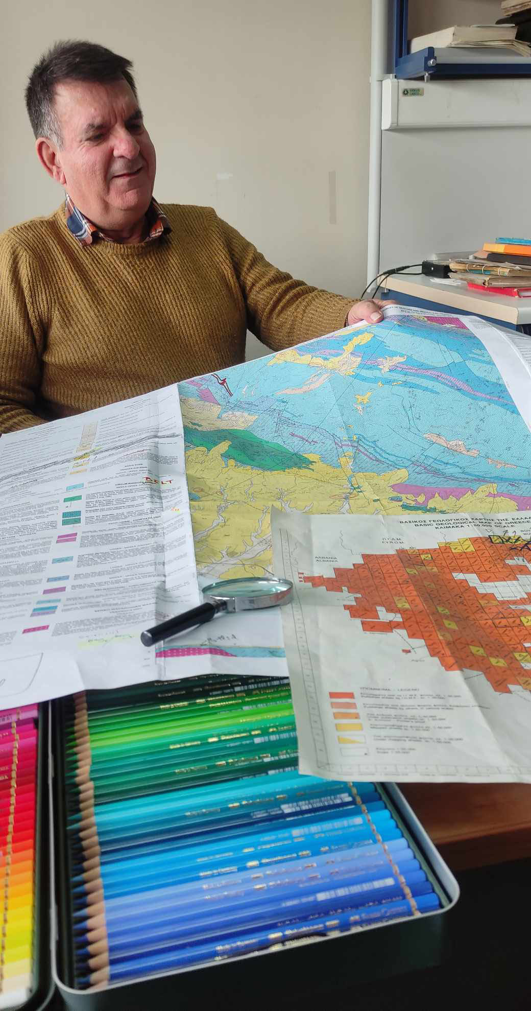
As he explains, its completion was based on the topographic maps provided to EAGME by the Military Geographical Service since the 1950s. The map is made up of 330 sheets, each representing a different area. Each sheet corresponds to 360 square kilometers of land. One third of the sheets are signed by Photiades.
To complete the geological mapping, he says, the first stage is fieldwork.
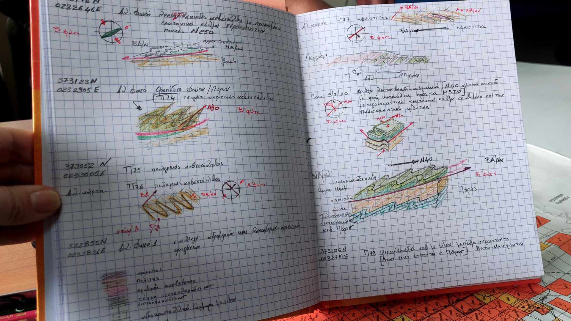
This is where the geologist collects the rocks, which are then sent to EAGME’s petrographic and paleontological laboratories for analysis.
Photiades spent what he calls “endless” hours in the field collecting samples. “There was one year when I was away from home for 200 days,” he says, and continues: “I used to hold a compass, now I hold a GPS. I used to hold a paper map, now the information is on my tablet. For the job, you need a good utility vehicle and a lot of stamina. Working in the field takes 10 to 12 hours a day. And it involves making a lot of notes in my notebook. I have never given that up, no matter how much technology has advanced,” he said.
Geology students, seismologists, technical experts at local authorities, infrastructure workers and engineers at construction companies will have a precision tool in their hands
In addition to Greek geologists, French and German cartographers also worked in the field. Photiades is, as he says, “of the French school,” having studied in France.
His first project with a team of French geologists dates back to the mid-1980s, when he was mapping the sheet for Lygourio in the eastern Peloponnese as part of his doctoral thesis.
Some sheets, he says, needed minimal revision, while others were missing too much information.
“At least 120 sheets made 60 years ago needed complete revision,” he explains, showing us the sheet for nearby Troizina, where work began in 1960 and was completed in 1984 in cooperation with German geologists.
“In general, the sheets of areas where sedimentary rocks dominate did not need much revision compared to those of areas with mainly igneous rocks. There was a lot of information missing,” he says.
Once the fieldwork is done, the laboratories to take over. The samples collected by geologists are examined by micropaleontologists. The field samples are “transformed” by the experts into microscopic specimens. Some of these can be seen at the museum in the EAGME building.
The laboratory reports with all the information about each rock, such as its age, are essential for the compilation of the footnotes of each sheet of the map.
As Photiades explains, “this extremely detailed and combined field and laboratory work led us to the mapping of granites up to 20 million years old. Igneous rocks were unknown in Greece. We worked with European colleagues to ‘decode’ them. The geochronology of the rocks is absolutely accurate.”
This is largely due to the recent upgrading of the technological tools available to EAGME. Thanks to these, microscopic, chemical and radiographic observations can be made. The rocks are even examined with X-rays.
Hundreds of shades
The phase following the laboratory studies is Photiades’ favorite and, as he says, “relaxes the mind of any cartographer.”
The reason for this is the coloring of the topographic sheets with the appropriate shade for each rock, fault etc. Based on an internationally defined palette, different colors are assigned to each rock and age.
Photiades’ desk is full of colored pencils. In front of the sheets of paper he has spread out to do the final touches, a box of 100 pencils made from the best pigments is prominently displayed.
“The Cyclades got a lot of color. They were difficult to reproduce because of their many metamorphic and igneous rocks, their volcanicity and the profusion of granite intrusions,” Photiades explains.
Each time he finished coloring a sheet, he handed it off to the digitization team. The revised and perfectly harmonized sheets are now available from EAGME in both printed and digital formats.
For Photiades, who will be retiring in five years at the most, the satisfaction of this map – a lifetime’s work for him – comes with a hidden fear: not to lose the art of the field geologist-mapper.