Landscape assessment at grassroots via geoinformatics
An intriguing and unique European research initiative, supervised by Greek experts, seeks to develop approaches and methodologies for assessing landscape quality in rural regions in order to safeguard it.
In fact, it employs as its primary tools, on the one hand, citizen engagement and, on the other, the most advanced technologies of geoinformatics and artificial intelligence.
The TOPIO project, “Towards Democratic Landscape Observation Through Geoinformatics and Public Participation,” involves seven European countries and led by the The Laboratory of Geophysics – Satellite Remote Sensing & Archaeoenvironment of The Foundation for Research and Technology – Hellas (FORTH).
According to Dr Dimitris Alexakis, the project’s coordinator project, the goal is “to offer European citizens an active role in decision making in the assessment of landscape quality, from the bottom up.”
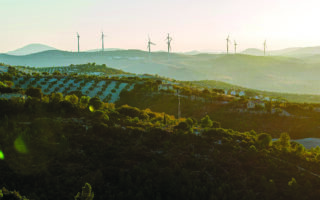
He added that the area of Falassarna, on the west coast of Crete, was chosen for Greece – an area with tourism, archaeological finds but also with agricultural crops and greenhouses.