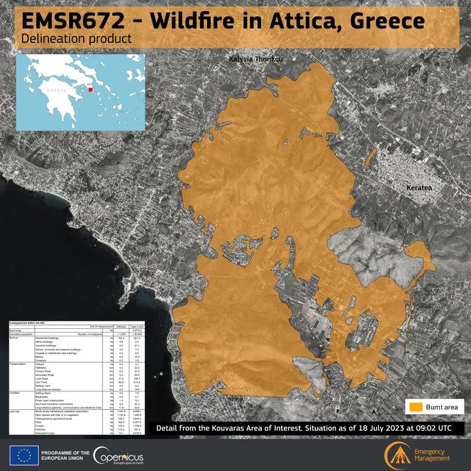
Copernicus says 3,472 hectares burnt in west Attica so far

The EU’s Copernicus/Emergency Management Service – Mapping service found that the ongoing wildfires in west Attica that started from the settlement of Kouvaras have destroyed 3,472 hectares, of which 164 were built-up areas, houses, businesses, farms etc.
The service was also activated for the areas in Viotia and Corinthia which have been affected by forest fires since July 17. Cartographic data and products resulting from the analysis of those satellite images are expected soon as the relevant Greek requests have been accepted by the European Union.
Copernicus has been extremely useful in environmental monitoring, climate change analysis and emergency management, assisting the Greek government in dealing with several environmental disasters.