Greek-US team maps Santorini volcano group
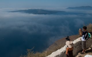
A team of Greek and American scientists has created a geomorphologic map for Santorini, which, they say, can “enhance hazard assessments” on the popular southeastern Aegean island.
Describing Santorini as a “tourist hot-spot,” the scientists from the universities of Athens, Tucson, Oregon and Arizona State, add that it is also “at high risk for volcanically- and seismically-induced hazards.”
The scientists, whose paper on the subject was published in the Journal of Maps on March 2, applied planetary geologic mapping methods to submarine data to create an onshore-offshore geomorphologic map of the Christiana-Santorini-Kolumbo Volcanic Group.
“Submarine geomorphologic maps are used to provide geologic context and spatial information on landforms and related geo-hazards for risk management,” they say in the abstract of their paper.