Mapping Greece’s seabed with brand-new tools
The Center for Marine Research has recently acquired the instruments to map out faults at least 2 km below the floor of the Aegean and Ionian
They are explorers of submarine faults, often at great depths, using sound waves as a guide in the darkness. They have been trying for decades to capture the geological “engravings” and underwater structures of Greece’s seabed so that seismologists can better “read” the future. The geologists of the state-run research organization Hellenic Center for Marine Research (HCMR) have been mapping the submarine faults in the Aegean and Ionian seas for years, as well as the Hellenic Trench – an oceanic trough located on the southern side of the Aegean Sea Plate.
For many years they worked with antiquated means but now they have much more modern and powerful research tools for capturing and understanding underwater geohazards.
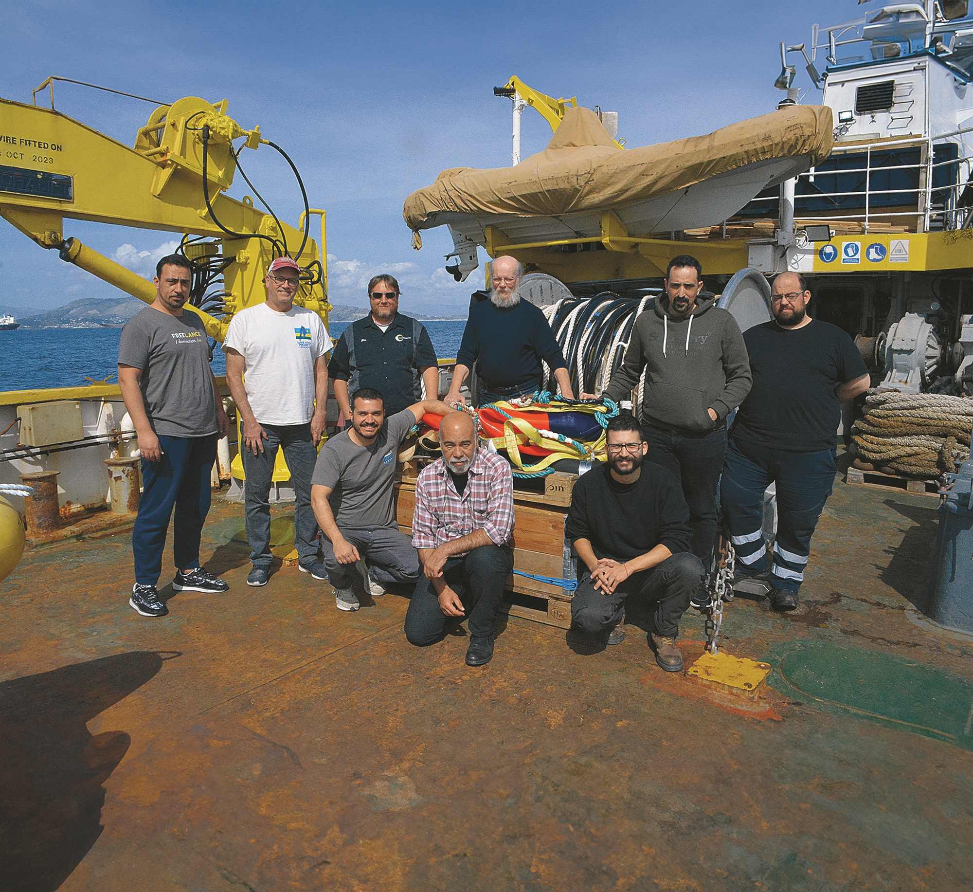
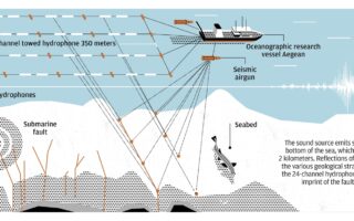
“A dream has come true. Until now we were working with an instrument that had much more limited capabilities. The old system sent a single-channel audio signal, the new one has 24 channels. The research capabilities are being drastically improved, firstly because the depth of penetration of the sound signal increases to at least 2 kilometers below the seabed (while before it did not exceed 1 km), and secondly because the quality of the seismic data is greatly improved,” Dr Dimitris Sakellariou, geologist and head of research at HCMR’s Institute of Oceanography and scientific manager of the “Athena vs Enceladus” program.
The new system of multi-channel seismic reflection installed on the HCMR oceanographic research vessel Aegean includes two seismic airguns with a maximum total volume of 5 liters (300 cubic inches compared to the previous one’s 40 cubic inches), a winch with a 24-channel hydrophone (350 meters long), the digital recording unit and the processing unit of the seismic sections.
Greece is the most earthquake-prone country in Europe and the sixth in terms of seismicity at an international level. The country sits at a crossroads of continents and tectonic plates that are always moving. As most earthquakes occur under the sea, the importance of knowing the geological structure of the seabed is crucial.
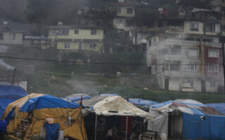
The strong seismic tremors that occurred on March 29 off the Strofades Islands in Western Greece confirmed this need. The 5.7-magnitude earthquake, which was preceded by a slightly weaker temblor, occurred at a depth of 20 kilometers, in one of the most seismic areas of the Hellenic arc. It did not cause any damage because its epicenter was in the sea and due to strict anti-seismic building regulations.
“The Greek maritime area is four times larger than the land, which means that geological phenomena such as earthquakes or landslides are mainly underwater,” Sakellariou explains. “Although we have established a database of 100-150 submarine faults, today less than 30% of the sea area has been systematically studied. In fact, this percentage does not include the most dangerous areas, such as those under Crete, in the Ionian, and the Kefalonia fault zone. One obstacle was the equipment, which did not allow us to ‘see’ very deep. But the main reason was that we did not have the necessary funding. And all the research that was done was financed by European or international programs, whereas the national participation was minimal.
‘Today less than 30% of the sea area has been systematically studied. This percentage does not include the most dangerous areas’
“We need more comprehensive research. We find great sea depths in our region, such as 2,500 meters in the area of Karpathos, 3,000-4,000 meters west of the Peloponnese. These are depths that we could not fully explore with the previous tools,” he continues.
While on land most faults are mapped, the same is not true in the sea. “In order for seismologists to be able to do studies and estimate what kind of earthquake a fault can produce, they must have data on the geological structure, the network of faults, how one affects the others,” Sakellariou says.
Better in the sea?
We often say that it is fortunate that most earthquakes occur at sea. “It has an element of truth, but it’s also a big trap,” Sakellariou replies. “If we’re talking about a 5.5-magnitude earthquake that occurs 50 kilometers off the coast, then it will be of little consequence, which won’t be the case if its epicenter is on land and close to a city. But if we have big earthquakes in the sea then the damage or even the destruction may be big.”
He points out that some of the biggest earthquakes that have occurred in our wider region have been underwater. “Submarine faults are no less threatening than land faults. If we also take into account that underwater earthquakes can cause tsunamis, they can be even more destructive than land ones,” he adds.
The installation of the new system on the Aegean lasted two weeks in the port of Piraeus and was completed with three days of tests at sea. “Not only was the successful completion of the installation of the complex new system not a given, but many times it seemed impossible. Firstly, because it was a dream of many years, which could not be realized due to the lack of funding. Secondly, because it presupposed significant interventions on the vessel,” Sakellariou says, adding that it became a reality thanks to the contribution of specialized technicians, the staff of HCMR’s Department of Marine Geology & Geophysics, and the crew of the ship.
Weighing anchor
The first mission with the upgraded system is planned for early summer and will involve researching the area between Crete in the south and the Cyclades in the north, the Peloponnese in the west and the island of Karpathos in the east. The next missions will include the Ionian Sea and the Kefalonia fault zone as well as the Hellenic Trench region from the south of the Peloponnese and Crete to the south of Rhodes.
The objectives of the research missions will be the study and understanding of the geological and tectonic evolution of these areas during the last hundreds, thousands and millions of years. Researchers will also map and study the active faults and their potential to cause large earthquakes, as well as the mapping of submarine landslides and the identification of areas that can generate tsunamis.